
THIS STORY HAS BEEN UPDATED
Forecasters at the National Hurricane Center say Tropical Storm Ian may appear a bit lopsided now, but think it will intensify very quickly in the next 24 hours, becoming a hurricane by Sunday and a major hurricane as early as Monday night.
“Significant to rapid intensification is expected while Ian crosses the northwestern Caribbean Sea,” said Hurricane Specialist Brad Reinhart in upping the intensity prediction.
Ian is still predicted to make landfall next week on Florida’s west coast, but forecasters say the overall track has shifted to the west, lessening the danger of a direct hit to South Florida.
But forecasters say it is too early to rule out a threat.
“There is still a lot of cross-track spread,” Reinhart said, saying the amount of uncertainty had increased after day three of the forecast.
The odds of tropical-storm force winds arriving in Miami were put at 29%, with the most likely time being Tuesday evening.

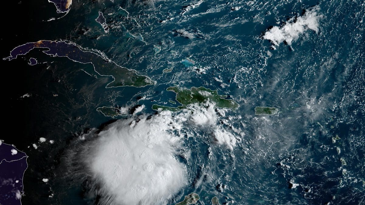
At 11 a.m., the center of Ian was about 270 miles south-southeast of Kingston, Jamaica, heading west at 15 miles-per-hour. Winds were put at 45 miles-per-hour.

A NOAA research jet will be flying later today to collect additional data to feed into computer models, and scientists will be launching additional weather balloons equipped with sensors to get a better picture of steering currents.
In Key Biscayne, Village Manager Steve Williamson and Fire Chief Eric Lang have been directing staff to be ready to respond, and have started coordinating with Miami-Dade County, Florida Power and Light, and the village’s debris removal contractor.
No decisions have been made about village services, but both urged residents to review their hurricane plans and to remember that Key Biscayne lies in a mandatory evacuation zone.
Decisions about any evacuation lie with Miami-Dade Mayor Daniella Levine Cava
“I’m going to cue off Mayor Cava,” Williamson said. “We have a close relationship with the County EOC (Emergency Operations Center).”
Forecasters gave the system the name “Ian” after a system developed off the coast of Africa a bit earlier, grabbing the name “Hermine.” It earlier had been called Tropical Depression Nine before being upgraded to tropical storm status.
Invest in Local News for Your Town. Your Gift is tax-deductible

Tony Winton is the editor-in-chief of the Key Biscayne Independent and president of Miami Fourth Estate, Inc. He worked previously at The Associated Press for three decades winning multiple Edward R. Murrow awards. He was president of the News Media Guild, a journalism union, for 10 years. Born in Chicago, he is a graduate of Columbia University. His interests are photography and technology, sailing, cooking, and science fiction.